Norway’s coast is a maze of fjords, islands, skerries and sheltered sounds that shaped everything from our cuisine to our shipping routes. Simple question, though: how long is it? You will see different answers depending on who you ask and how they measure.
Short answer: If you include every fjord and island edge that hugs the mainland, Norway’s coastline is commonly cited as about 100,915 kilometers. Break that into parts and you get roughly 28,953 kilometers for the mainland plus 71,963 kilometers around islands, based on figures long used by our national mapping authorities. Some updated sources round the grand total to about 102,900 kilometers, which reflects newer datasets and slightly different map scales. Either way, Norway sits behind only Canada globally.
Curious why the numbers aren’t identical everywhere, what is actually being measured, and what this means when you plan a trip along the coast? Let’s dig in.
Why the coastline length changes depending on who answers
The length of a coastline is a classic case of the coastline paradox: the more closely you trace every nook and cranny, the longer the line gets. Use a coarse “ruler” and you smooth over small bays and islets, so the total shrinks. Use high resolution data and hug every curve, and it grows. So, the number you see always depends on the measurement method and map scale.
In Norway’s case, our fjords slice deep into the land and we have hundreds of thousands of islands and skerries. That complexity is why older national figures once hovered around 83,000 kilometers and later jumped past 100,000 when the Norwegian Mapping Authority used better data and a finer scale. Same country, finer measurement, longer line.
The most useful figures at a glance
When you’re comparing numbers, make sure you’re comparing like with like. Here are the figures most frequently cited in Norway, all measured at consistent national scales:
- Mainland coastline, including fjords and bays: 28,953 km
- Coastline around islands: 71,963 km
- Total coastline (mainland plus islands): 100,915 km
- Number of islands: 239,057
- Number of skerries: 81,192
You will also see reputable Norwegian sources state the total as about 102,900 kilometers today. That reflects updates to basemaps and small methodological tweaks rather than a suddenly “longer” Norway. Think of 100,915 km and 102,900 km as siblings in the same family of measurements, not conflicting truths.
What counts as “Norway” here?
Most general figures refer to mainland Norway plus its nearshore islands, not Svalbard or Jan Mayen. Many global league tables do include those arctic territories (or they mix sources), which can nudge totals and rankings around the edges. When you read a number, check whether the article says “including all islands” and whether it is explicit about Svalbard. If it is silent, assume it means the mainland and its islands, excluding Svalbard.
Straight-line perimeter vs. true coastal edge
Another number you might stumble on is a coastal perimeter of roughly 2,650 kilometers. That is essentially the length of a neat, simplified line along the outer edge of Norway if you ignore most indentations. It is conceptually useful for maritime boundaries but not what travelers picture when they think of “coastline.”
Is Norway really number two in the world?
Yes, in typical national datasets Norway ranks second after Canada in total coastline length when you include all fjords and islands at commonly used map scales. The exact ranking depends on how each country is measured and the resolution used, but Norway consistently lands in the number-two spot.
How the coast you experience compares to the statistics
As a Norwegian who grew up with the sea in easy reach, I can tell you the statistics ring true once you start traveling.
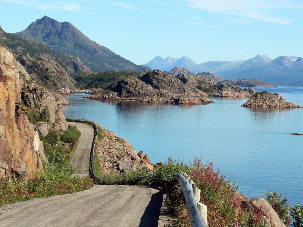
- Fjords create long detours on land. Drive the E39 south of Bergen and you will meet ferry crossings that exist because roads do not dare to trace every inlet. It is a reminder that what looks close on a map can be hours away by car. This is the coastline paradox in daily life.
- Maritime routes stitch the country together. The coastal express and regional boats turn our serrated shoreline into a highway. Boarding a ship north in winter, with snow on the deck and quiet lights in the next harbor, you meet the coast as people here actually use it.
- Weather shapes plans. The exposed headlands like Stad and Hustadvika are infamous among sailors. When the wind pipes up, locals respect the sea and schedule around it. That is not drama, just routine wisdom.
Practical tips for travelers following the coast
If the coastline numbers made you curious about exploring it properly, here is how to turn that curiosity into a plan that fits the geography.
Blend road and sea travel
The coast’s character shows best when you mix modes. Drive a scenic stretch, then swap to a boat or ferry to hop a cluster of islands. It breaks up driving while giving you the soft rhythm of moving over water. Consider one leg by coastal ship in winter for northern lights potential and a different leg by car in late spring when roads are dry and days are long.
Budget time instead of distance
A 150-kilometer day by fjord can be a very full day. Ferry timetables, speed limits through villages, and the temptation to stop for viewpoints all add pleasant friction. Plan fewer daily kilometers than you would in inland Europe, especially if you are traveling with kids.
Use shoulder seasons wisely
April to early June and late August into September are lovely on the coast. You get good daylight, fewer crowds, and a nice hit of local life before or after peak season. Autumn gives extra drama in the surf and a shot at clear air for photos.
Aim for contrasts
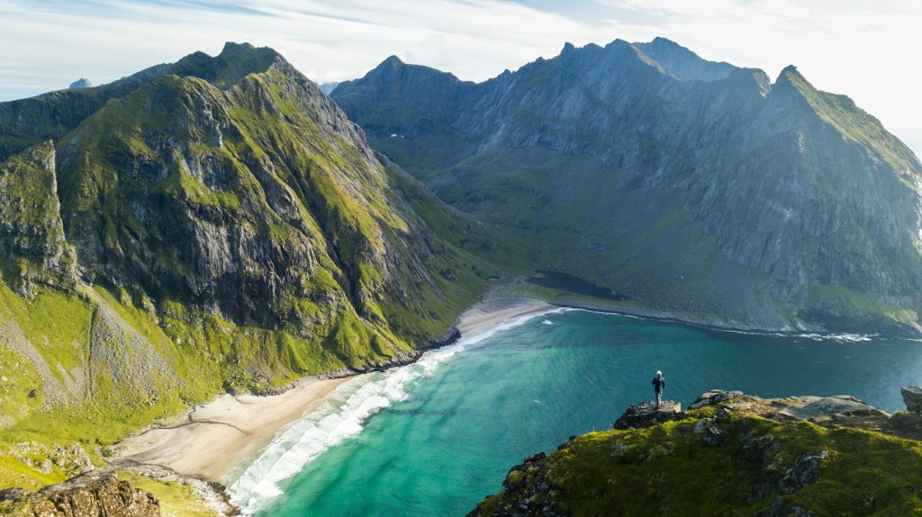
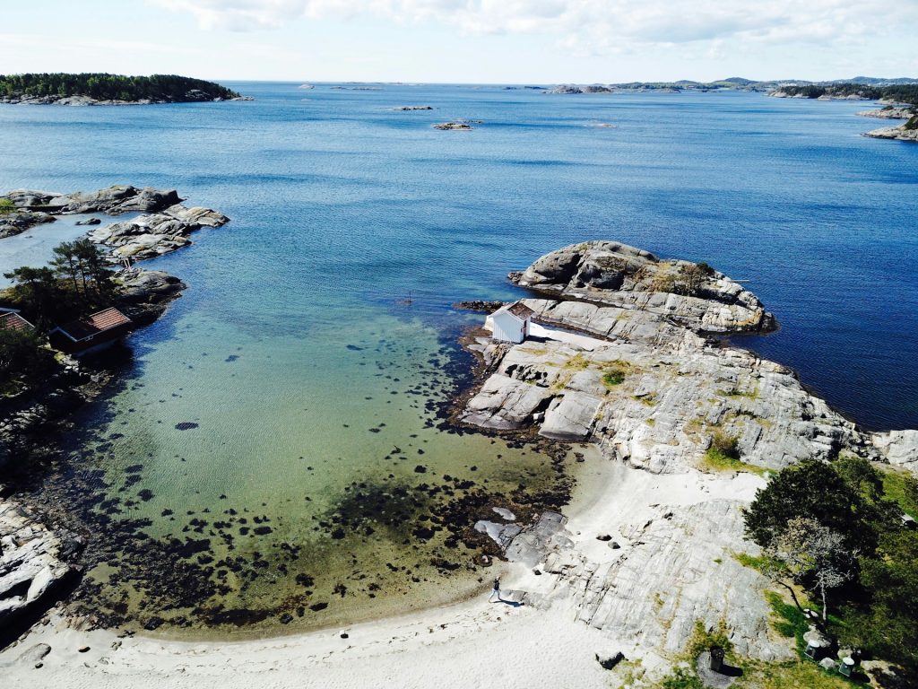
Norway’s coast is not one thing. Stack your itinerary with opposites: a protected archipelago near Arendal, a wave-washed beach on Jæren, a towering fjord arm like Nærøyfjorden, and a fishing village in Lofoten or Vesterålen. The variety is what makes those six-figure coastline totals make sense.
Respect the sea
If you rent a small boat to poke around islands, study charts and local advice. Currents, reefs and weather can change a lazy afternoon quickly. The coast is generous, but it does not coddle.
A simple way to visualize the numbers
If “100,000 kilometers” still feels abstract, try this: Norway’s coastline, traced at common national mapping scales, is long enough to wrap around the Earth two and a half times if you could lay it out straight. That image sticks with you the first time you stand on a quay at low tide and look along a town’s jumble of boathouses and rock ledges. The line never really ends.
How authorities actually measure it
Behind the scenes, geodata teams use national shoreline datasets built from aerial and satellite imagery, lidar and field checks. The map scale matters. A coarser product smooths over the tiniest coves and reef edges. A finer product keeps them, which inflates length. When Norway updated its official mapping in the 2000s and 2010s, the total coastline increased not because the land changed, but because the mapping got more detailed. That is why you will see both ~100,915 km and ~102,900 km in modern Norwegian references.
What this means for planning big infrastructure
Our rugged shoreline complicates everything from road building to shipping safety. It is not an accident that Norway has explored unique solutions like a ship tunnel at Stad or concepts for submerged floating tunnels to tame monster fjord crossings. Whether those projects move fast or slow, they exist because the coastline is not just long. It is complex.
So, how long is Norway’s coastline?
If you want a single, trustworthy figure to carry with you, use about 101,000 kilometers. If you want the classic breakdown that many Norwegian references still print, keep 28,953 km for the mainland, 71,963 km for islands, and 100,915 km in total. And if someone at a dinner table slaps down a different number, you can smile and ask them what map scale they used. That is the Norwegian way: practical, a little geeky, and always shaped by the sea.